
The Netherlands topographic map
Interactive map
Click on the map to display elevation.
About this map
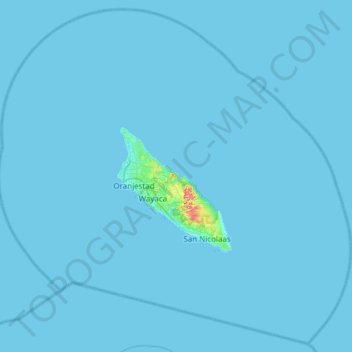
Name: The Netherlands topographic map, elevation, terrain.
Location: Aruba, The Netherlands (12.26278 -70.26959 12.82300 -69.66123)
Average elevation: 1 m
Minimum elevation: 0 m
Maximum elevation: 189 m
Other topographic maps
Click on a map to view its topography, its elevation and its terrain.
Sint Eustatius
The Netherlands > Caribbean Netherlands
Sint Eustatius is 6 miles (10 km) long and up to 3 miles (5 km) wide. Topographically, the island is saddle-shaped, with the 602 meter-high dormant volcano Quill (Mount Mazinga), (from Dutch kuil, meaning 'pit'—originally referring to its crater) to the southeast and the smaller summits of Signal Hill/Little…
Average elevation: 8 m