
Courchevel 1650 (Moriond) topographic map
Interactive map
Click on the map to display elevation.
About this map
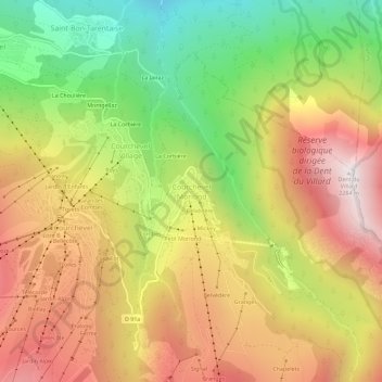
Name: Courchevel 1650 (Moriond) topographic map, elevation, terrain.
Average elevation: 1,594 m
Minimum elevation: 875 m
Maximum elevation: 2,281 m