
Majuli topographic map
Interactive map
Click on the map to display elevation.
About this map
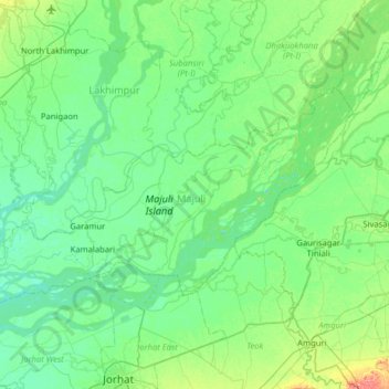
Name: Majuli topographic map, elevation, terrain.
Location: Majuli, Assam, 785104, India (26.86653 93.95991 27.18552 94.59583)
Average elevation: 90 m
Minimum elevation: 73 m
Maximum elevation: 169 m
Other topographic maps
Click on a map to view its topography, its elevation and its terrain.