
Kangchenjunga topographic map
Interactive map
Click on the map to display elevation.
About this map
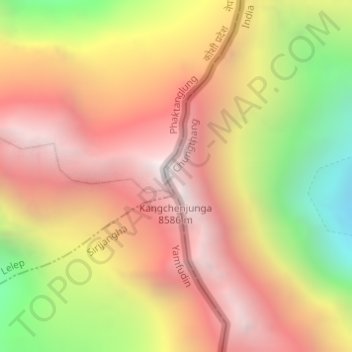
Name: Kangchenjunga topographic map, elevation, terrain.
Average elevation: 7,714 m
Minimum elevation: 6,502 m
Maximum elevation: 8,587 m
Other topographic maps
Click on a map to view its topography, its elevation and its terrain.
Zemu Glacier
Zemu Glacier, North District, North Sikkim District, Sikkim, India
Average elevation: 5,499 m
North District
North District, North Sikkim District, Sikkim, India
Average elevation: 3,842 m