
Buzi River topographic map
Interactive map
Click on the map to display elevation.
About this map
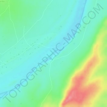
Name: Buzi River topographic map, elevation, terrain.
Location: Buzi River, Manica, Mozambique (-19.92127 33.84158 -19.91938 33.84506)
Average elevation: 61 m
Minimum elevation: 31 m
Maximum elevation: 126 m
Other topographic maps
Click on a map to view its topography, its elevation and its terrain.