
Ward 4 topographic map
Interactive map
Click on the map to display elevation.
About this map
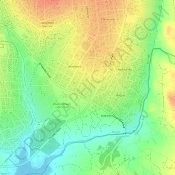
Name: Ward 4 topographic map, elevation, terrain.
Location: Ward 4, Epworth, Harare Province, Zimbabwe (-17.92856 31.15088 -17.90043 31.17529)
Average elevation: 1,480 m
Minimum elevation: 1,452 m
Maximum elevation: 1,505 m