
Sylhet topographic map
Interactive map
Click on the map to display elevation.
Sylhet
In Bengal, Sylhet has been called as Srihôṭṭô (in Bangla : শ্রীহট্ট) or Srihatta since the ancient time in the Bengali and regional Siloti language. The name Sylhet is an anglicisation of Shilhot (শিলহট). Its origins seem to come from the Sanskrit according to the words of শিলা śilā (meaning stone) and হট্ট haṭṭa (meaning marketplace). These words match the landscape and topography of the hilly region. The shila stones were abundant across Sylhet and the King Gour Govinda is known to have used stones to guard his capital. The word had changed to Shilhot due to the elision of letter-final অ ô in the Bengali language.
About this map
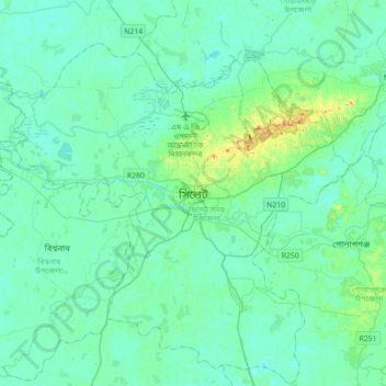
Name: Sylhet topographic map, elevation, terrain.
Location: Sylhet, Sylhet District, Sylhet Division, 3100, Bangladesh (24.73922 91.70853 25.05922 92.02853)
Average elevation: 14 m
Minimum elevation: 4 m
Maximum elevation: 66 m