
Huanchaco topographic map
Interactive map
Click on the map to display elevation.
About this map
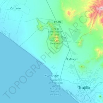
Name: Huanchaco topographic map, elevation, terrain.
Location: Huanchaco, Province of Trujillo, La Libertad, 045, Peru (-8.13313 -79.21050 -7.89226 -78.92180)
Average elevation: 174 m
Minimum elevation: -1 m
Maximum elevation: 2,093 m
Other topographic maps
Click on a map to view its topography, its elevation and its terrain.