
Sakesar topographic map
Interactive map
Click on the map to display elevation.
About this map
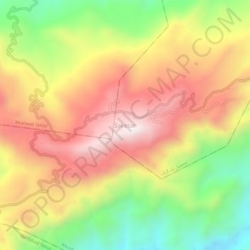
Name: Sakesar topographic map, elevation, terrain.
Location: Sakesar, Sargodha District, Punjab, Pakistan (32.52328 71.91277 32.56328 71.95277)
Average elevation: 1,124 m
Minimum elevation: 688 m
Maximum elevation: 1,517 m