
Centro topographic map
Interactive map
Click on the map to display elevation.
About this map
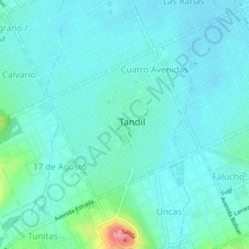
Name: Centro topographic map, elevation, terrain.
Average elevation: 195 m
Minimum elevation: 178 m
Maximum elevation: 286 m
Other topographic maps
Click on a map to view its topography, its elevation and its terrain.
Falucho
Argentina > Buenos Aires > Tandil
Falucho, Tandil, Partido de Tandil, Buenos Aires, Argentina
Average elevation: 211 m
Villa del Lago
Argentina > Buenos Aires > Tandil
Villa del Lago, Tandil, Partido de Tandil, Buenos Aires, Argentina
Average elevation: 246 m