
Ruisseau de Landeyran topographic map
Interactive map
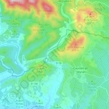
Click on the map to display elevation.
About this map
Name: Ruisseau de Landeyran topographic map, elevation, terrain.
Average elevation: 172 m
Minimum elevation: 46 m
Maximum elevation: 545 m
Other topographic maps
Click on a map to view its topography, its elevation and its terrain.
Col des Tribes
France > Occitanie > Causses-et-Veyran
Col des Tribes, Causses-et-Veyran, Béziers, Hérault, Occitanie, France métropolitaine, 34490, France
Average elevation: 230 m