
Lugo topographic map
Interactive map
Click on the map to display elevation.
About this map
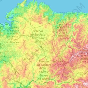
Name: Lugo topographic map, elevation, terrain.
Location: Lugo, Galicia, Spain (42.32601 -7.99978 43.76176 -6.81406)
Average elevation: 510 m
Minimum elevation: -2 m
Maximum elevation: 2,095 m
Other topographic maps
Click on a map to view its topography, its elevation and its terrain.