
Thuringia topographic map
Interactive map
Click on the map to display elevation.
About this map
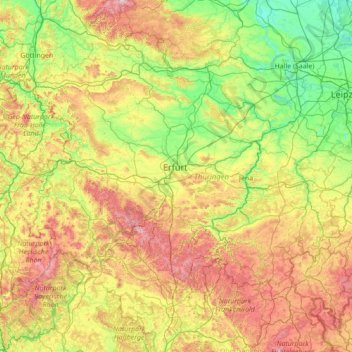
Name: Thuringia topographic map, elevation, terrain.
Location: Thuringia, Germany (50.20435 9.87672 51.64894 12.65392)
Average elevation: 341 m
Minimum elevation: 56 m
Maximum elevation: 1,106 m
Other topographic maps
Click on a map to view its topography, its elevation and its terrain.