
Chirorwe topographic map
Interactive map
Click on the map to display elevation.
About this map
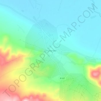
Name: Chirorwe topographic map, elevation, terrain.
Location: Chirorwe, Musoma, Mara, Lake Zone, Tanzania (-1.83850 33.65505 -1.79850 33.69505)
Average elevation: 1,208 m
Minimum elevation: 1,141 m
Maximum elevation: 1,384 m