Geolocate

Gurdaspur topographic map

Interactive map

Click on the map to display elevation.

About this map

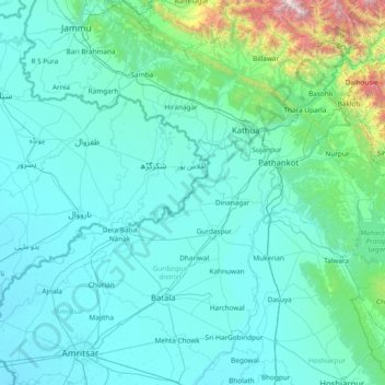
Name: Gurdaspur topographic map, elevation, terrain.

Location: Gurdaspur, Punjab, India (31.52667 74.67667 32.80667 75.95667)

Average elevation: 461 m

Minimum elevation: 217 m

Maximum elevation: 3,737 m

Other topographic maps

Click on a map to view its topography, its elevation and its terrain.

Jalandhar

India > Punjab

Jalandhar, Punjab, India

Average elevation: 241 m

Talwan

India > Punjab > Talwan

Talwan, Jullundur, Jalandhar, Punjab, India

Average elevation: 236 m

Sutlej River

India > Punjab

Sutlej River, Ludhiana, Punjab, 172026, India

Average elevation: 1,539 m

Jalandhar

India > Punjab > Jalandhar

Jalandhar, Jalandhar I Tahsil, Jalandhar, Punjab, 144001, India

Average elevation: 237 m