
Rukwa topographic map
Interactive map
Click on the map to display elevation.
About this map
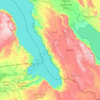
Name: Rukwa topographic map, elevation, terrain.
Location: Rukwa, Southern Highlands Zone, Tanzania (-9.07614 30.26108 -6.88606 32.49314)
Average elevation: 1,238 m
Minimum elevation: 762 m
Maximum elevation: 2,470 m