
Aomori Prefecture topographic map
Interactive map
Click on the map to display elevation.
About this map
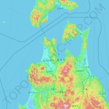
Name: Aomori Prefecture topographic map, elevation, terrain.
Location: Aomori Prefecture, Japan (40.21772 139.23411 41.60606 141.90397)
Average elevation: 120 m
Minimum elevation: -5 m
Maximum elevation: 1,591 m