
Alachua County topographic map
Interactive map
Click on the map to display elevation.
About this map
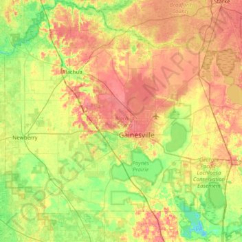
Name: Alachua County topographic map, elevation, terrain.
Location: Alachua County, Florida, United States of America (29.41706 -82.65855 29.94525 -82.04905)
Average elevation: 33 m
Minimum elevation: 5 m
Maximum elevation: 67 m
Other topographic maps
Click on a map to view its topography, its elevation and its terrain.
Miami-Dade County
United States of America > Florida
Miami-Dade County, Florida, United States of America
Average elevation: 3 m