
Yamanashi Prefecture topographic map
Interactive map
Click on the map to display elevation.
About this map
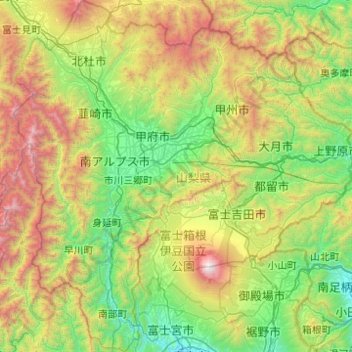
Name: Yamanashi Prefecture topographic map, elevation, terrain.
Location: Yamanashi Prefecture, Japan (35.16838 138.18009 35.97171 139.13441)
Average elevation: 1,019 m
Minimum elevation: 18 m
Maximum elevation: 3,719 m
78% of the prefecture is covered by forests, making it one of the most densely wooded prefectures in Japan. Land cultivated for agriculture is mainly restricted to the lower elevations of the Kōfu basin.