
Marktgemeinde Schruns topographic map
Interactive map
Click on the map to display elevation.
About this map
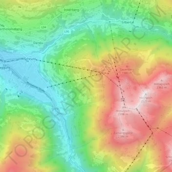
Name: Marktgemeinde Schruns topographic map, elevation, terrain.
Location: Marktgemeinde Schruns, Bezirk Bludenz, Vorarlberg, 6780, Austria (47.04359 9.88647 47.09475 9.98806)
Average elevation: 1,375 m
Minimum elevation: 660 m
Maximum elevation: 2,484 m