
Waukesha County topographic map
Interactive map
Click on the map to display elevation.
About this map
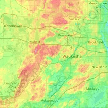
Name: Waukesha County topographic map, elevation, terrain.
Location: Waukesha County, Wisconsin, United States of America (42.84195 -88.54216 43.19608 -88.06334)
Average elevation: 272 m
Minimum elevation: 222 m
Maximum elevation: 369 m
Other topographic maps
Click on a map to view its topography, its elevation and its terrain.
Gays Mills
United States of America > Wisconsin > Gays Mills
Gays Mills, Crawford County, Wisconsin, United States of America
Average elevation: 272 m
Door County
United States of America > Wisconsin
Door County, Wisconsin, United States of America
Average elevation: 191 m