
Jigawa topographic map
Interactive map
Click on the map to display elevation.
About this map
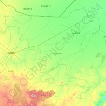
Name: Jigawa topographic map, elevation, terrain.
Location: Jigawa, Nigeria (10.94221 8.12784 13.02757 10.60208)
Average elevation: 434 m
Minimum elevation: 300 m
Maximum elevation: 1,117 m
The state has a total land area of approximately 22,410 square kilometres. Its topography is characterized by undulating land, with sand dunes of various sizes spanning several kilometres in parts of the State. The southern part of Jigawa comprises the basement complex while the northeast is made up of sedimentary rocks of the Chad Formation. The main rivers are Hadejia, Kafin Hausa and Iggi Rivers with a number of tributaries feeding extensive marshlands in north-eastern part of the State. Hadejia – Kafin Hausa River traverses the state from west to east through the Hadejia-Nguru wetlands and empties into the Lake Chad Basin.
Other topographic maps
Click on a map to view its topography, its elevation and its terrain.