
Thank you for supporting this site ❤️
Make a donation
Make a donation
Richmond Hill topographic map
Click on the map to display elevation.
Thank you for supporting this site ❤️
Make a donation
Make a donation
Richmond Hill
The village of Richmond Hill was incorporated by a bylaw of the York County Council on June 18, 1872, coming into effect January 1, 1873. In September 1956, the Ontario Municipal Board approved its elevation to Town status, effective January 1, 1957.
Thank you for supporting this site ❤️
Make a donation
Make a donation
About this map
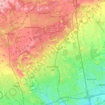
Name: Richmond Hill topographic map, elevation, terrain.
Average elevation: 256 m
Minimum elevation: 171 m
Maximum elevation: 350 m
Thank you for supporting this site ❤️
Make a donation
Make a donation