
Brand-Erbisdorf topographic map
Interactive map
Click on the map to display elevation.
About this map
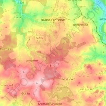
Name: Brand-Erbisdorf topographic map, elevation, terrain.
Location: Brand-Erbisdorf, Mittelsachsen, Saxony, 09618, Germany (50.79668 13.22489 50.88725 13.35529)
Average elevation: 490 m
Minimum elevation: 359 m
Maximum elevation: 591 m