
Nonthaburi Province topographic map
Interactive map
Click on the map to display elevation.
About this map
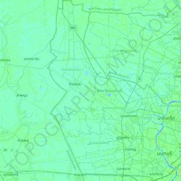
Name: Nonthaburi Province topographic map, elevation, terrain.
Location: Nonthaburi Province, Thailand (13.78916 100.26238 14.14085 100.56760)
Average elevation: 4 m
Minimum elevation: -4 m
Maximum elevation: 16 m
Other topographic maps
Click on a map to view its topography, its elevation and its terrain.
Nonthaburi
Thailand > Nonthaburi Province > Nonthaburi
Nonthaburi, Bang Bua Thong District, Nonthaburi Province, 11110, Thailand
Average elevation: 4 m