
Pulau Pagai Utara topographic map
Interactive map
Click on the map to display elevation.
About this map
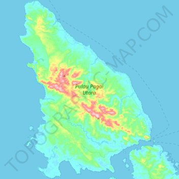
Name: Pulau Pagai Utara topographic map, elevation, terrain.
Location: Pulau Pagai Utara, West Sumatra, Indonesia (-2.85234 99.95965 -2.50269 100.22315)
Average elevation: 28 m
Minimum elevation: -1 m
Maximum elevation: 319 m
Other topographic maps
Click on a map to view its topography, its elevation and its terrain.