
Site of Community Importance Serra da Estrela topographic map
Interactive map
Click on the map to display elevation.
About this map
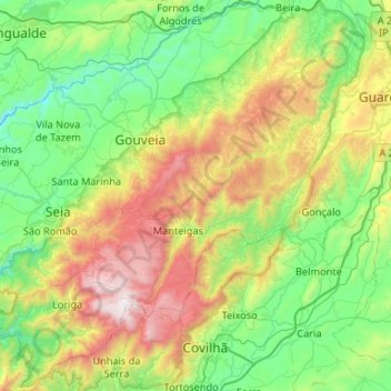
Name: Site of Community Importance Serra da Estrela topographic map, elevation, terrain.
Average elevation: 742 m
Minimum elevation: 220 m
Maximum elevation: 1,989 m
Other topographic maps
Click on a map to view its topography, its elevation and its terrain.