
Karlovac County topographic map
Interactive map
Click on the map to display elevation.
About this map
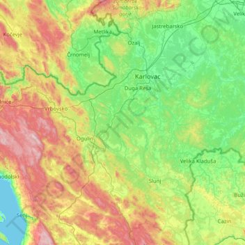
Name: Karlovac County topographic map, elevation, terrain.
Location: Karlovac County, Croatia (44.88666 14.96348 45.76255 15.92504)
Average elevation: 395 m
Minimum elevation: 0 m
Maximum elevation: 1,501 m
Other topographic maps
Click on a map to view its topography, its elevation and its terrain.