
Iğdır topographic map
Interactive map
Click on the map to display elevation.
About this map
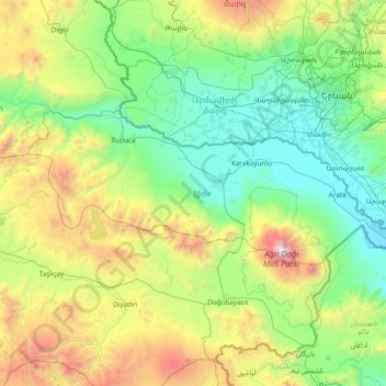
Name: Iğdır topographic map, elevation, terrain.
Location: Iğdır, Eastern Anatolia Region, Turkey (39.62734 43.28427 40.13158 44.81766)
Average elevation: 1,707 m
Minimum elevation: 802 m
Maximum elevation: 5,053 m