
Chipata topographic map
Interactive map
Click on the map to display elevation.
About this map
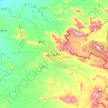
Name: Chipata topographic map, elevation, terrain.
Location: Chipata, Eastern Province, PO BOX 510292, Zambia (-13.79907 32.48572 -13.47907 32.80572)
Average elevation: 1,133 m
Minimum elevation: 882 m
Maximum elevation: 1,668 m