
Kassel topographic map
Interactive map
Click on the map to display elevation.
About this map
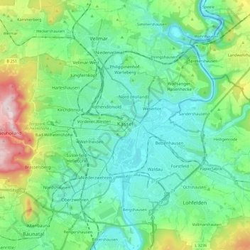
Name: Kassel topographic map, elevation, terrain.
Location: Kassel, Niestetal, Hesse, Germany (51.26044 9.35008 51.36901 9.56976)
Average elevation: 226 m
Minimum elevation: 125 m
Maximum elevation: 560 m