
Trenton topographic map
Interactive map
Click on the map to display elevation.
About this map
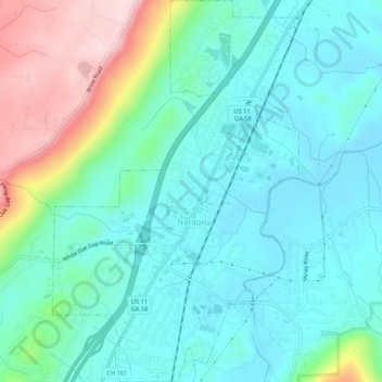
Name: Trenton topographic map, elevation, terrain.
Location: Trenton, Dade County, Georgia, United States (34.85374 -85.52850 34.89734 -85.49415)
Average elevation: 280 m
Minimum elevation: 205 m
Maximum elevation: 508 m