Thank you for your support if you like this site ❤️Make a donation
Кашка Суу topographic map
Click on the map to display elevation.
About this map

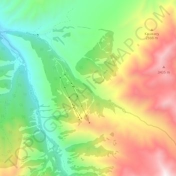
Name: Кашка Суу topographic map, elevation, terrain.
Location: Кашка Суу, Issyk-Kul Region, Kyrgyzstan (42.38215 78.43516 42.42346 78.52122)
Average elevation: 2,631 m
Minimum elevation: 1,998 m
Maximum elevation: 3,567 m
Other topographic maps
Click on a map to view its topography, its elevation and its terrain.


North Engilchek Glacier
North Engilchek Glacier, Issyk-Kul Region, Kyrgyzstan
Average elevation: 4,156 m

Ala-Kul Lake
Kyrgyzstan > Issyk-Kul Region > Karakol
Ala-Kul Lake, Karakol, Issyk-Kul Region, Kyrgyzstan
Average elevation: 3,704 m
